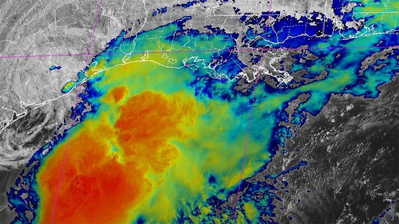
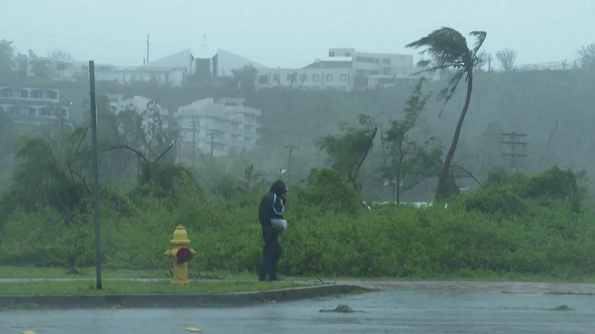
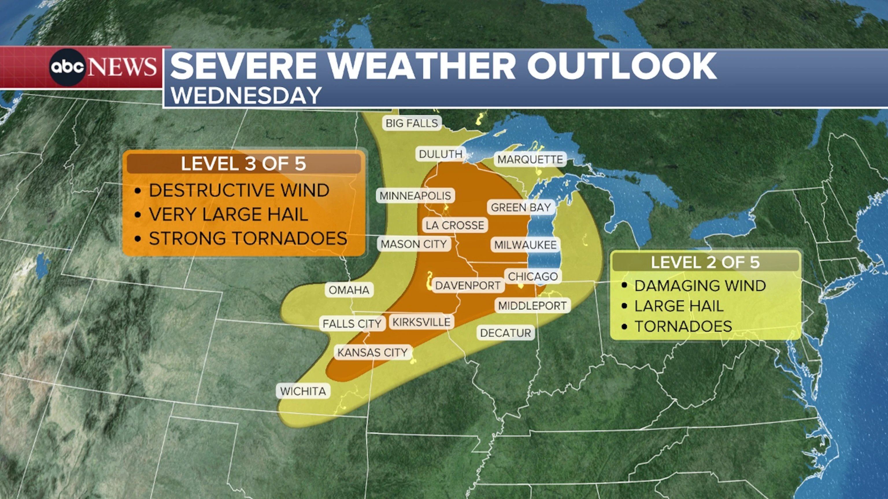
Tropical Storm Arthur, the first named storm of the 2026 Atlantic hurricane season, has weakened to a post-tropical cyclone after making landfall along the Gulf Coast. Despite its downgrade, the National Weather Service warns that it still poses a potential for "life-threatening flash flooding." Arthur formed near Port O'Connor, less than 50 miles from the Texas coast, and was centered about 35 miles northeast of Galveston, Texas, and 85 miles west-southwest of Lake Charles, Texas, late Wednesday night. Arthur developed as a tropical disturbance in the western Gulf of Mexico earlier this week. Forecasters predicted its remnants would move inland over southeastern Texas and western Louisiana, then cross the southeastern United States Thursday through Friday.
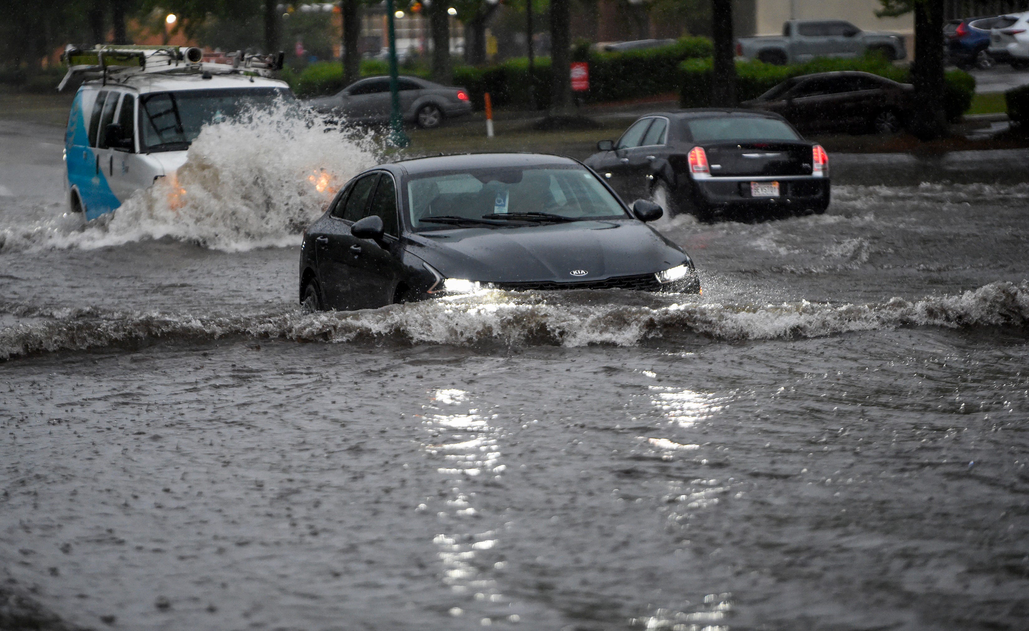
The hurricane center forecasts that Arthur will likely dump 5 to 10 inches of rain on sections of Texas, Louisiana, Mississippi, Alabama, and the western portions of the Florida Panhandle through early Friday. This rainfall could generate dangerous to life-threatening flash flooding. Coastal communities have already experienced bouts of intense rain that triggered dangerous flash flooding in multiple states. The remnants of Arthur will continue to produce widespread heavy rains, with "life-threatening flooding" expected to persist in parts of the region.
In addition to flash flooding, the storm is expected to produce "life-threatening surf and rip current conditions along the northwestern Gulf Coast for the next day or two." The hurricane center also warns that some tornadoes are possible due to the storm's lingering effects.
The Atlantic hurricane season runs from June 1 to November 30, with activity usually peaking between August and October. Forecasters predict this season will bring fewer storms than an average year, with the National Oceanic and Atmospheric Administration's latest outlook calling for eight to 14 named storms, of which three to five might grow into hurricanes. This outlook provides a measure of what communities along the Atlantic coast can anticipate in terms of weather-related risks for the remainder of the season.
Tropical Storm Arthur, the first named storm of the 2026 Atlantic hurricane season, has weakened to a post-tropical cyclone after making landfall along the Gulf Coast. Despite its downgrade, the National Weather Service warns that it still poses a potential for "life-threatening flash flooding." Arthur formed near Port O'Connor, less than 50 miles from the Texas coast, and was centered about 35 miles northeast of Galveston, Texas, and 85 miles west-southwest of Lake Charles, Texas, late Wednesday night. The storm, which initially developed in the western Gulf of Mexico, is expected to move inland over southeastern Texas and western Louisiana, then cross the southeastern United States Thursday through Friday.
The hurricane center forecasts that Arthur will likely dump 5 to 10 inches of rain on sections of Texas, Louisiana, Mississippi, Alabama, and the western portions of the Florida Panhandle through early Friday. This rainfall could generate dangerous to life-threatening flash flooding. Coastal communities have already experienced bouts of intense rain that triggered dangerous flash flooding in multiple states. The remnants of Arthur will continue to produce widespread heavy rains, with "life-threatening flooding" expected to persist in parts of the region.
In addition to flash flooding, the storm is expected to produce "life-threatening surf and rip current conditions along the northwestern Gulf Coast for the next day or two." The hurricane center also warns that some tornadoes are possible due to the storm's lingering effects.
The Atlantic hurricane season runs from June 1 to November 30, with activity usually peaking between August and October. Forecasters predict this season will bring fewer storms than an average year, with the National Oceanic and Atmospheric Administration's latest outlook calling for eight to 14 named storms, of which three to five might grow into hurricanes. This outlook provides a measure of what communities along the Atlantic coast can anticipate in terms of weather-related risks for the remainder of the season.
As Tropical Storm Arthur's remnants move inland, affected communities must remain vigilant and prepared for ongoing heavy rains and potential flash flooding. Emergency services and local authorities are advised to maintain readiness to respond to any weather-related incidents that may arise from the storm's aftermath. Residents in the path of the storm are urged to stay informed about local weather updates and to take necessary precautions to protect their safety and property.
Highlighted text was flagged by the council. Tap to see feedback.